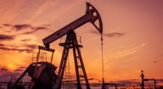
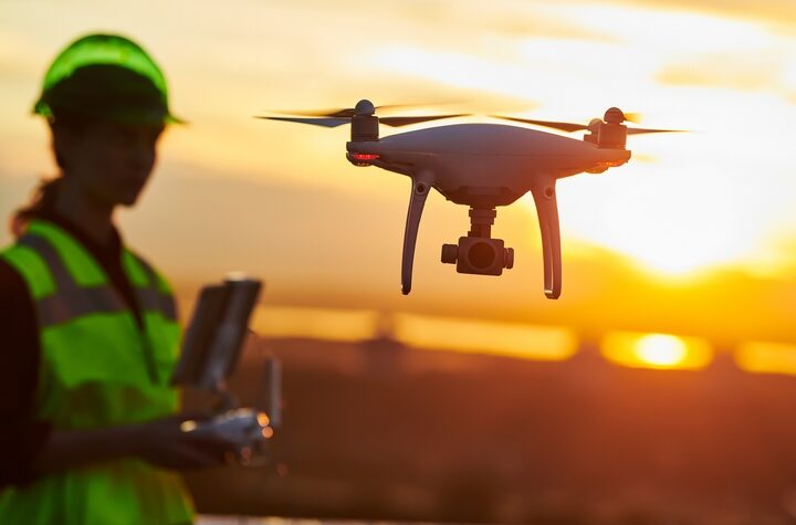
In the modern construction industry that moves fast, being ahead depends on careful planning, good management and smart choices. The use of drones to map areas and take photographs from the air has been a massive step forward in progress. They make it possible for construction teams to gather valuable information from the very start of a job up to the end. Drones help make data collection faster and easier in building residential or massive buildings and infrastructure.
What Is 3D Mapping in Construction?
3D mapping in construction is about making three-dimensional digital models of construction sites or future building areas. With high-quality photos taken by drones, software can link photos vertically to construct exact and interactive 3D models. With these models, people can get detailed views of the area, find distances, estimate sizes and chart their achievements at steps ahead in construction.
The Role of Drone Photography and Aerial Videography
Drone photography plays a central role in capturing detailed overhead images of construction sites. Photos taken by high-resolution cameras on drones can reach hundreds during one flight and these are analyzed by photogrammetry software to make 3D maps and orthomosaic images. With these images, engineers and planners can imagine what the site looks like before visiting it.
Similarly, aerial videography provides a dynamic overview of the job site. Being able to view the site from several angles and heights is useful for managers reporting to clients, watching remote inspections and checking on staff safety. While images are fixed, video can illustrate growth, management strategies and processes on the site.
Positive Aspects of 3D Mapping and Aerial Imaging for Construction Project Design
1. Accurate Site Analysis
It’s very important to understand the land features before any construction work begins. Traditional ground surveys are often time-consuming and labor-intensive. Drone-based 3D mapping is able to survey extensive zones in the shortest possible time with extreme accuracy. They allow the earthwork team to see the entire landscape, with slopes, changes in elevation and natural features which guide their planning and choices.
2. Improved Collaboration and Communication
Visual data speaks louder than blueprints. Aerial imaging allows departments to communicate with one another and also with external stakeholders. Both remote architects and interested investors can use drone images as a standard reference. With the integration of high-definition photography, you can work more closely with software used in BIM (Building Information Modeling).
3. Monitoring and Documentation
Once construction begins, it’s important to track development regularly. Every week or every day, drones may be used to take images and make sure the 3D model remains up to date. They are used to check if the project is going as the plans foresee. In this way, accountability improves and possible problems are spotted early, preventing them from becoming serious delays.
4. Volume and Distance Calculations
Frequently, 3D mapping allows straightforward estimation of the volume of soil, gravel and aggregates needed in construction work. In a short time, managers have data they can trust for handling resources, making plans and reducing waste.
5. Enhanced Safety
Safety is always a top priority in construction. Drone photography allows supervisors to inspect hard-to-reach or hazardous areas without putting workers at risk. Many inspections can be carried out in the air, including examining the roof, scaffolding and earth digging and this can replace the use of ladders, scaffolding or people flying over.
Getting Started with Drone-Based 3D Mapping
When you want to start using 3D mapping and aerial imaging for your construction project, here’s what you should do:
- Choose a drone that has GPS, strong cameras and the ability to sense things in its path. Major construction companies use the DJI Phantom 4 RTK and Matrice series for their jobs.
- Pick the Software – Pick software such as Pix4D, DroneDeploy or Autodesk ReCap. The tools take your photos and produce 2D maps and 3D models for you.
- Prepare Your Route – Most maps offer tools to predetermine the flight routes you want to use. This path will help the drone take pictures that match each other.
- After getting your aerial images, use the software to organize and analyze your data. Within hours, you’ll receive fully rendered maps and models.
- Evaluate and Share – Base planning, teamwork and changes on the data. Supply the visualizations to your team, the clients and the contractors whenever needed.
Final Thoughts
The integration of 3D mapping, drone photography, and aerial videography into construction planning has changed the game. They help make surveys faster, decisions more precise and communication more effective which also improves safety and efficiency. With technological developments, the role of technology in construction is also increasing. Modern companies that want to grow should treat drone-based aerial images as a key requirement rather than just a bonus.